
Seamanship Series – Chapter 1: Andeluna Passage Pittwater to Noumea
Authors: Peter and Judith Mitchley
We signed up for the Island Pacific Rally 2026, which for Australian participants, leaves from Southport at the end of April. The suggested route to New Caledonia is to hold an easterly course until about two-thirds of the way across before turning north to safeguard against being headed by easterly trade winds on approach. We opted to depart from Coffs Harbour for a better wind angle but still wanted to set off from Australia at the same time as the Southport rally fleet on 24 April (about 10 boats in all).
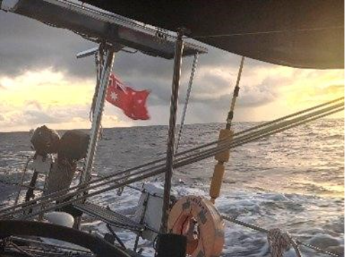
We left Pittwater on 21 April in 25 to 30 knots of southerly wind with a 4m southerly swell and a secondary easterly cross swell. It was a rolling passage! We made good time to Port Stephens. The entrance was lively with the swell. We picked up a mooring for the night off Dutchman’s Beach. After a leisurely breakfast and in daylight we departed for Coffs.
We entered Coffs just before 0700h the following morning after an unpredictable night. The updated forecast had been for 20–25 knots from the SE, with 3.8m swell (8s period) and with a cross swell. However, the seas were probably a little bigger and the wind came from anywhere randomly at between 30–40 knots. From around 4 am onward we had a westerly. The preventer did a great job on three unplanned gybes as the wind swirled. The entrance to Coffs was “interesting” with breakers across the bar. Marine Rescue advised the crossing would be OK if we chose our moment between the sets and stayed close to the southern rock wall.
We waited in Coffs marina for just over a week for a suitable weather window. Border Force were very accommodating, friendly and helpful. We left on the back of a low pressure system which was forecast to give us 15–25 knots on the starboard beam. Our only weather surprise was how squally it was on the trip. On the morning of the third day, we had 2–3 squalls per hour rolling through. Fortunately, the squalls were easily spotted on radar and we could reef down in preparation.
We made Port Moselle marina, Noumea in 5 days and two hours, averaging 182 nautical miles per day through the water with no breakages, mishaps or injuries. Sleeping was difficult due to the rolling conditions; a bean bag wedged between the saloon bench and table proved a surprisingly effective solution.
Land Cruise
Shortly after arrival in Noumea, with rain forecast, we undertook a land cruise around Grande Terre which is the main island of New Caledonia. It is a long, mountainous island surrounded by one of the world’s largest lagoons, combining rugged interiors with extensive coral reef systems.
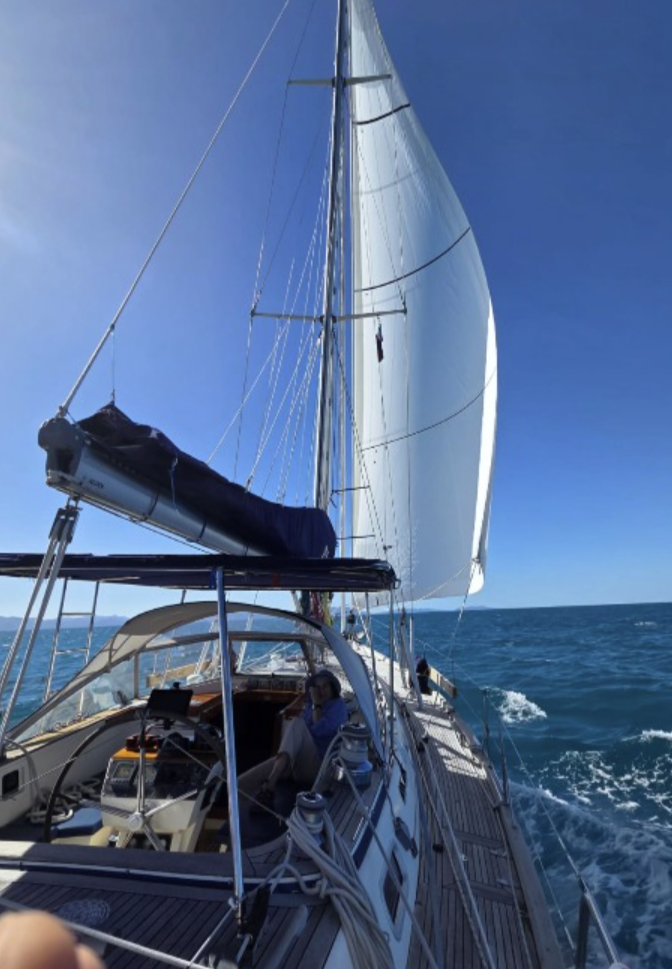
Below is a photo of us sailing at 6.5 knots in the lagoon.
The interior is lush and mountainous, becoming increasingly remote in the north where facilities are sparse but the scenery is spectacular.
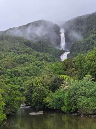
Cascade de Tao – located in the remote north of Grande Terre, this waterfall drops through dense rainforest into a tranquil basin, characteristic of the island’s rugged and undeveloped interior.

Peter at Bonhomme de Bourail – a striking sedimentary rock formation on the west coast, shaped by erosion into a recognisable human profile (fi your squint) and standing prominently offshore.
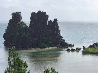
We also saw La Poule de Hienghène – an iconic limestone formation rising sharply from the lagoon on the northeast coast, one of New Caledonia’s most distinctive natural landmarks.
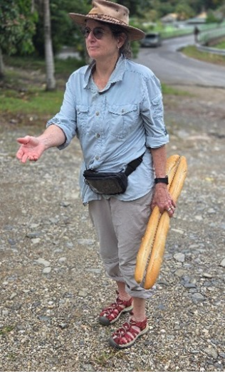
Judith foraging for baguettes – highlighting the strong French influence throughout New Caledonia, where fresh bread is a daily staple even in remote areas.
Environmental Observations
New Caledonia has extensive nickel deposits, particularly in the south, where large open-cut mining operations are visible. These appear to have limited erosion control, with sediment runoff impacting surrounding lagoons – a notable contrast to the otherwise pristine environment.

We are now anchored in Ouvea, New Caledonia.
Five Seamanship takeaways from the trip so far.
Our five personal seamanship reflections from our crossing are:
a. There is almost always lots of time at sea; time that can be used to prepare. We also used the time to keep a watch on our Radar which allowed us to see squalls that would suddenly double or triple the wind strength.
b. Have a Plan B. In contradiction to point (a) above, equipment failures, or the unexpected happen; often bad things cascade compounding the problem. So check the little things that can cascade into big things, like a loose shackle.
c. Despite routinely, conservatively reefing down at sunset, we still had a fast crossing. A flat boat is a fast boat!
d. Consult and share route planning reasons thoroughly with your spouse/crew. Without that shared in-depth knowledge a crew member can with good intent (wind shift, marine traffic, etc) alter course and place the boat in danger or adverse current. (another boat parked on a reef when one the couple decided to shortcut from the route over open water on the vector chart!)
e. It’s difficult to sleep sliding about on a matrass, notwithstanding a narrow sea berth with lee cloth. Our large bean bag found another use! Without being cocooned it’s not possible to relax one’s muscles to get a good sleep when it’s very rolly.